
T’aqrachullo: The Largest Inca Citadel in Espinar, Cusco
T’aqrachullo: The Inca Citadel That Rivals Machu Picchu
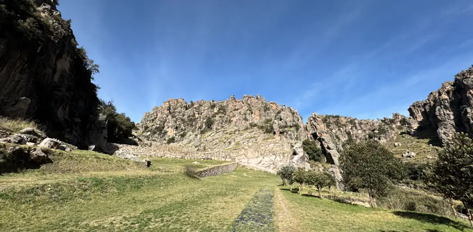
244 km from Cusco, on a plateau overlooking the Apurímac River canyon, a complex of nearly 600 structures awaits those willing to seek out a Peru still free of crowds.
What is T’aqrachullo?
T’aqrachullo, also known as María Fortaleza, is a pre-Hispanic archaeological complex located in the Suyckutambo district, Espinar province, Cusco region. Its name comes from Quechua: t’acra (mother rock) and chullo (frozen water). During the colonial period, the Spanish renamed it “María Fortaleza” when they reused its stone structures.
The site sits at over 4,100 meters above sea level on a plateau offering direct views of the Apurímac canyon and the snowcapped peaks of southern Cusco. Peruvian archaeologists have been studying it since at least the 1990s, when archaeologist Alicia Quirita from the Universidad Nacional San Antonio Abad del Cusco conducted the first systematic visits.
🧠
History and Archaeological Significance
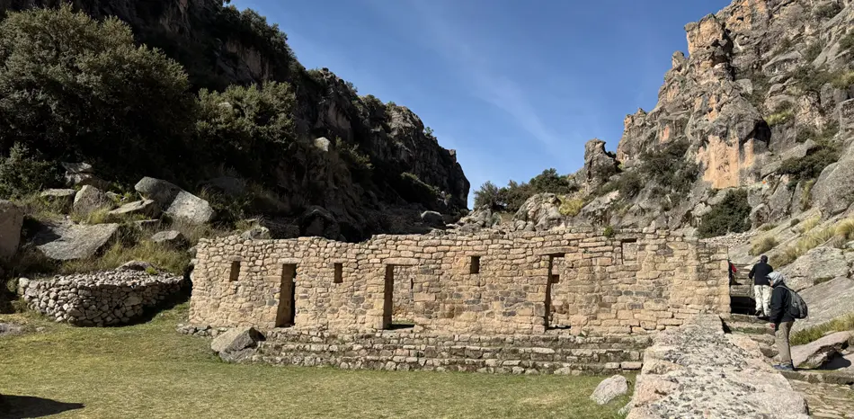
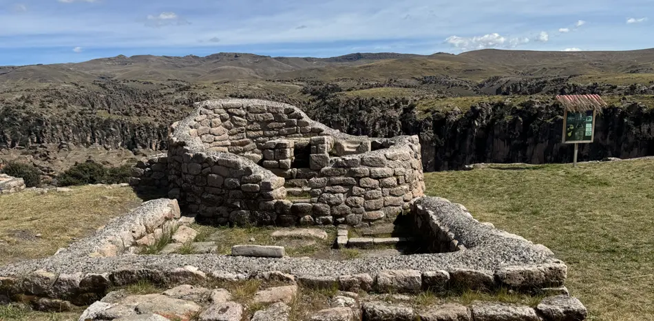
Research suggests T’aqrachullo was successively occupied by pre-Inca cultures and later by the Tawantinsuyo as a political, economic, and religious center. It was declared a National Cultural Heritage site in 2010. Between 2019 and 2022, Peru’s Ministry of Culture carried out restoration and documentation work that transformed knowledge of the site — from a scatter of ruins to a complex of nearly 600 identified structures, including dwellings, tombs, sanctuaries, ceremonial fountains, and funerary spaces.
National Geographic published a detailed feature in 2026 placing T’aqrachullo in international archaeological debate, though Peruvian specialists are careful to note that the media “discovery” does not reflect the decades of prior local research.
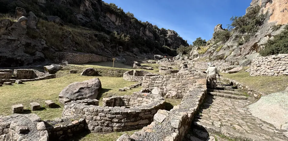
Main Structures
- Elite dwellings with fine masonry
- Circular and rectangular chullpas (funerary towers)
- Sanctuaries and ceremonial fountains
- Section of the Qhapaq Ñan (Inca Road)
- Storage compounds (qollqas)
- Deposits of elite artifacts
How to Get There
| Origin | Main Route | Distance / Approx. Time |
|---|---|---|
| Cusco | Cusco–Espinar highway to Yauri, then dirt road to Suyckutambo and Totorani bridge | 244 km · ~5.5–6 h |
| Arequipa | PE-34A → Juliaca → Patahuasi → Chivay → Callalli → Sibayo → Suyckutambo | ~7 h |
| Puno | PE-34A → Juliaca → Imata → Yauri → Suyckutambo | ~6 h |
| Apurímac | PE-3Sw from Chalhuahuacho → Abra Acopunco → Santo Tomás → Velille → Coporaque → Suyckutambo | ~5 h |
🧭
Best Time to Visit
The dry season (May to October) offers clear skies and low rain risk — ideal for photography and trekking. The wet season (November to April) turns the landscape intensely green, though dirt tracks become more challenging.
What to Bring
- Layered warm clothing
- Sunscreen and UV sunglasses
- Water (at least 2 liters / 67 fl oz)
- High-energy snacks
- Basic first aid kit
- Local guide or offline GPS
⚠️

Want to visit T’aqrachullo?
We organize private and group expeditions to Espinar’s lesser-known archaeological sites. Includes transport, specialist guide, and accommodation.


