
K’anamarca: The Warrior Capital of the K’ana Nation Before the Inca Empire
9 miles (15 km) northeast of Yauri and at 13,290 ft (4,050 m) altitude, a 44-hectare complex guards the secrets of a nation that existed centuries before the Incas traced their first road south.
Who Were the K’ana?
The K’ana culture was one of the most important highland lordships of southern Peru before the expansion of the Tawantinsuyo. The term K’ana comes from Aymara and can be translated as “braided” or “glowing,” while marka (also Aymara) means “village” or “place.” The full site name, K’anamarca, therefore translates as “braided village” or “interwoven people.”
The K’ana inhabited the Espinar plateaus from very early times. When Inca Pachacútec began his expansion southward, the K’ana negotiated their incorporation into the Tawantinsuyo and became strategic allies, particularly as a fighting force against the Chancas, who resisted Cuzqueñan expansion.
🧠
The Archaeological Complex
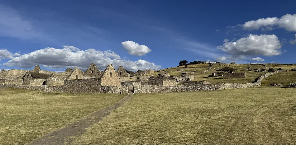
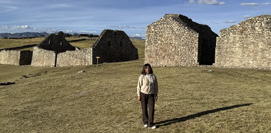
K’anamarca sits in a natural hollow at 12,960–13,290 ft (3,950–4,050 m) and covers a total area of 44 hectares (109 acres). The structures are built in stone and adobe, with circular and rectangular floor plans reflecting the coexistence of pre-Inca and Inca occupation periods.
The complex is divided into two main sectors: Tinkuq (upper part) and Tupaq Yupanqui (lower part), names that allude to both the site’s geography and its periods of use.
Key Sectors and Structures
| Sector / Structure | Description |
|---|---|
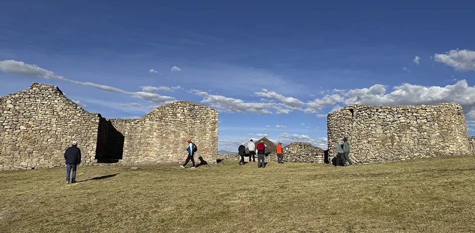
| Tinkuq (upper zone) | Ceremonial and administrative area; circular and rectangular enclosures |
| Tupaq Yupanqui (lower zone) | Residential and funerary zone; tombs and storage spaces |
| Inka Pirwa | Restored sector with evidence of superimposed Inca architecture |
| Quta Q’asa | Sector with funerary structures and panoramic views |
| Irokancha | Possible temple or ritual enclosure, restoration now complete |
| Pre-Hispanic road | Section of the road system connecting K’anamarca with Cusco and the altiplano |
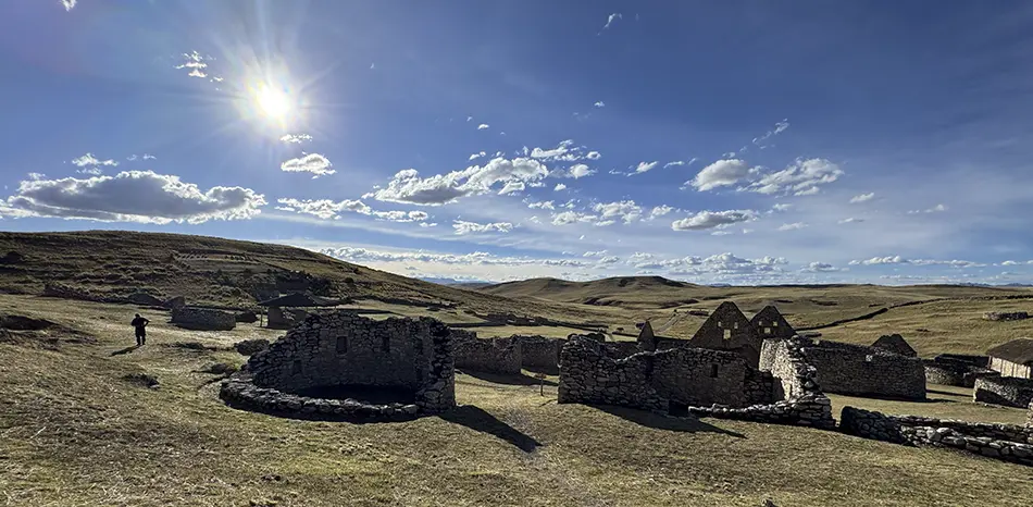
Landscape and Setting
K’anamarca is surrounded by sacred hills recognized by the local community: Inkapirwa, P’usuqueña, and other apus of the K’ana tradition. Llamas and alpacas grazing among the ruins add a living, contemporary dimension to the archaeological space. The altitude and landscape extend offer exceptional conditions for landscape photography and astrophotography during the dry season.
How to Get There
| Origin | Route | Distance / Time |
|---|---|---|
| Cusco | Huayruropata terminal → bus to Espinar (147 mi / 236 km). Get off at the K’anamarca turnoff; then 20–30 min walk. | ~147 mi (236 km) · ~4.5–5 h |
| Yauri (Espinar) | Espinar–Sicuani–Cusco paved road; turn right onto dirt track, 3 mi (5 km). | 9 mi (15 km) · ~25 min by car |
| Private car from Cusco | Direct route; turn 9 mi (15 km) NE of Yauri, then 20–30 min walk to the site. | ~147 mi (236 km) · ~4.5 h |
🧭
Best Time to Visit
The dry season (May–October) is recommended: clear skies, unobstructed views, and accessible roads. In the wet season (November–April), the site is partially covered in snow on the coldest days and the landscape turns intensely green. Both offer distinct photographic value.
⚠️
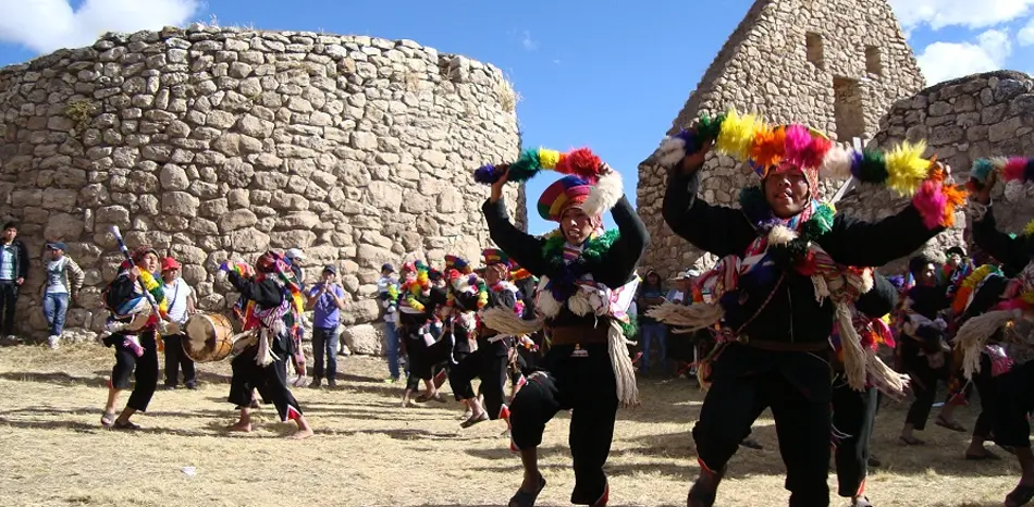
Cultural Festival
K’anamarca is the venue for a traditional K’ana dance festival that draws communities from Espinar and neighboring provinces. The event reinforces cultural continuity between the pre-Hispanic past and the present-day communities of southern Cusco.
Explore the K’ana nation from Cusco
We design archaeological tours to K’anamarca, Mauk’allaqta, and T’aqrachullo — three destinations that tell the full story of Espinar. Private groups, specialist guide, and complete logistics.


