
Mauk’allaqta: The Ancient Town Overlooking the Apurímac Canyon
Mauk’allaqta: The Ancient Town Overlooking the Apurímac Canyon
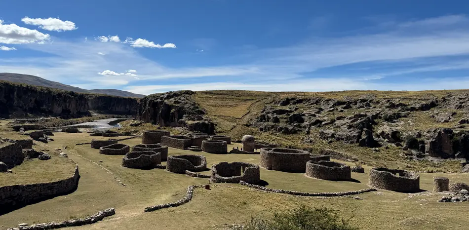
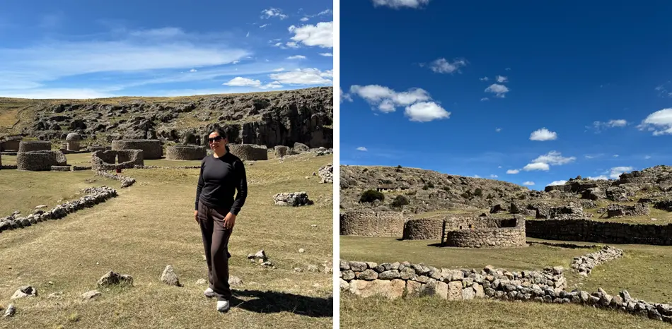
In the community of Manturca, on the banks of the Apurímac River at 12,845 ft (3,915 m) altitude, a set of pre-Inca chullpas rises at the edge of the Virginniyoc canyon with a monumentality that no photograph fully captures.
What Mauk’allaqta Means
The name combines two Quechua words: mawk’a (ancient) and llaqta (town, city, nation). The direct translation is “ancient town” or “old city.” The site has been known locally by this name since before modern records, and should not be confused with similarly named sites in Paruro (Cusco) or Arequipa.
Location and Access
Mauk’allaqta is located in Espinar province, on the border of the Coporaque and Suykutambo districts, 26 km from Yauri (Espinar’s capital) and 177 miles (285 km) from Cusco city. It stands on the banks of the Hank’amayu and Apurímac rivers, within the Virginniyoc canyon.
| Detail | Value |
|---|---|
| Altitude | 11,025–12,845 ft (3,360–3,915 m), varies by sector |
| Distance from Cusco | 177 mi (285 km) |
| Distance from Yauri (Espinar) | 16 mi (26 km) |
| Travel time from Cusco | 6–8 hours by vehicle |
| Final access | Dirt track from Chaupimayu to Manturca |
| Admission | Free (restored and open to the public) |
History and Occupation Periods
Archaeological evidence indicates that Mauk’allaqta was an urban center inhabited by pre-Inca cultures, possibly associated with the Qanaqiri or groups predating Cuzqueñan expansion. Later, the Tawantinsuyo incorporated the settlement and added its own structures, resulting in the coexistence of construction elements from different periods.
A notable episode in local oral history is the Tipi ritual: upon abandoning the site, residents deliberately broke all ceramics and marked funerary spaces with an X, symbolizing the departure of the deceased. This act of ritual rupture left a unique archaeological record.
Peru’s National Institute of Culture carried out restoration work on the complex, recovering circular and rectangular enclosures, the main chullpa, and the walls of the pre-Hispanic road.
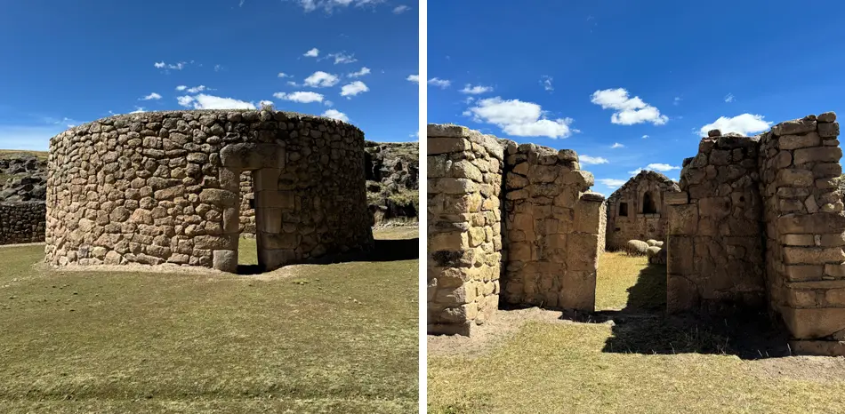
Main Structures
| Structure | Description |
|---|---|
| Main chullpa | Funerary tower of fine architecture, up to 115 ft (35 m) tall, built in dressed stone |
| Circular enclosures | Possible ceremonial or residential spaces from the pre-Inca period |
| Rectangular enclosures | Inca-period structures typically associated with administrative functions |
| Pre-Hispanic road | Restored road segment with retaining wall |
| Funerary spaces | Sealed enclosures with evidence of the Tipi ceramic-breaking ritual |
🧠
Landscape and Natural Setting
The site occupies the rim of the Virginniyoc canyon, where the Apurímac River runs between sheer rock walls. On clear days, you can hear the sound of water from the upper structures. The confluence of the Hank’amayu and Apurímac rivers, visible from the site, is itself a point of geographic and photographic interest.
When to Visit and What to Bring
The dry season (April to October) is most advisable. Frosts are frequent from May to October, with temperatures that can reach -4 °F (-20 °C) on the coldest nights. During the wet season, dirt track access can become difficult.
🧭
Discover Mauk’allaqta with local experts
We combine a visit to Mauk’allaqta with the Garganta del Diablo and other Apurímac canyon highlights in Espinar. 2–3 day tours from Cusco with guide, transport, and accommodation.


